This post was updated in June, 2024.
While working on my GIS certification at the University of Southern Maine one of my favorite projects was a hypothetical transit network connecting Portland, ME and the Casco Bay islands. Take a look at this utopian problem statement. Only something I could write two presidential election cycles ago:
The passing of the 28th Amendment (forbidding the use of all fossil fuels in the year 2030) presents a difficult problem for the residents of the Casco Bay islands. Currently, the islands are connected through a network of ferry and private shipping routes, all which rely on fossil fuels. In response to this problem, the newly created Rapid Area Transit of Casco Bay (RATCaB) was awarded a generous GREEN-TIGER grant from the U.S. Department of Transportation to improve the public transportation between the major islands of Casco Bay. The multi-million dollar grant will provide the necessary funds to accomplish all the goals set forward by this committee:
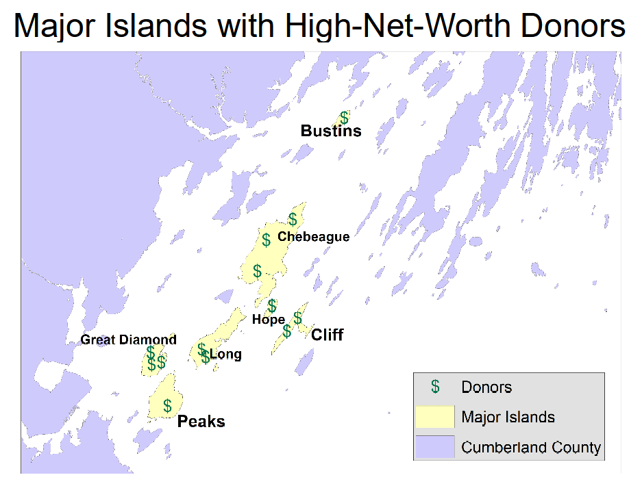
1.) Connect all major islands1 of Casco Bay by constructing a world-class, zero-emissions public transportation network.
2.) This network must give preference to island population centers, and the donors who generously contributed to our reelection campaigns.
3.) Capitalize on the invention of future transportation technologies by incorporating them alongside legacy transit methods.
4.) Reduce environmental, economic, and construction costs by utilizing our wealth of geographic mapping resources.
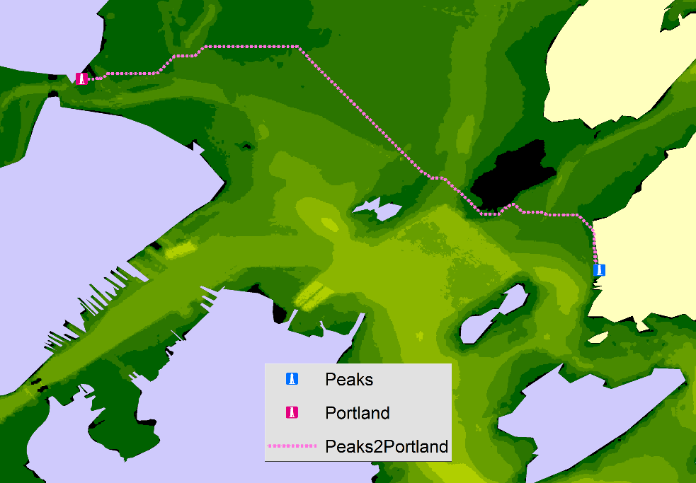
This was the first time I used Arc’s Network Analyst extension. In years since I have replicated the same workflows tens of times using QGIS’s network analysis tools because I almost am always working with vector-only data.. and the Network Analyst extension costs extra.

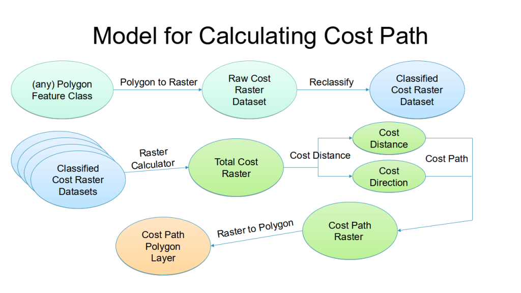
To weight the route I used a few datasets:
- Eelgrass (Zostera marina) beds weighted higher (from the 2018 From the Maine DEP & Casco Bay Estuary Partnership). Eelgrass is a flowering underwater plant, providing food and shelter for a great variety of commercially and recreationally important fish. Eelgrass is vulnerable to poor water quality, disease, shading effects from docks and piers, disturbance from boating traffic, and the impacts of rising water temperature.
- Construction Depth weighted higher (Portland, Maine 1/3 arc-second MHW Coastal Digital Elevation Model)
- Donor Locations
- Existing transit hubs


